☰ Menu
Images
Products
Log in
Basket:
0
items
Popular
Subjects
Artists
Collections
Art prints
Frames
Canvases
Postcards
Gift cards
Liszt Collection
(page 259)
Showing 9289 to 9324 of 25000+
Filter +
Featured
A-Z
Z-A
Oldest to newest
Newest to oldest
Bestselling
Aspect ratio
All
Square images
Landscape images
Portrait images
Key artists
All
John James Audubon
Eugene Boudin
Henri Boutet
Mary Cassatt
Paul Cezanne
Edgar Degas
Ernst Haeckel
Paul Gauguin
Vincent van Gogh
Claude Monet
Berthe Morisot
Auguste Renoir
Henri de Toulouse-Lautrec
Kitagawa Utamaro
Edouard Vuillard
James Mcneill Whistler
Origin
All
Chinese
Dutch
French
German
Italian
Japanese
Russian
Spanish
Turkish
Selected subjects
Belle Epoque
Birds
Cartoons
Children
Fashion
Fine art
Natural history
Posters
Apply filters
×
Clear all
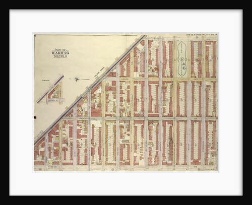
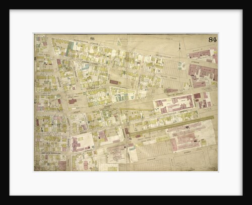
Map bounded by Broadway, Saratoga Ave; IncludingDecatur St., Patchen Ave., New York
Anonymous
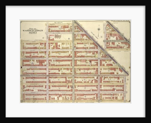
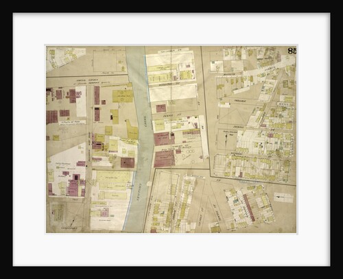
Map bounded by Broadway, Vernon Av., New York
Anonymous
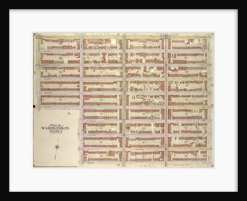
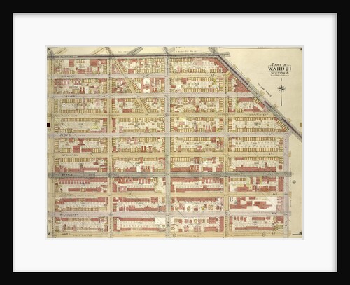
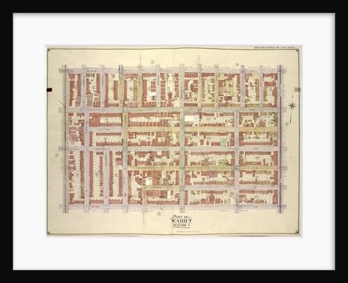
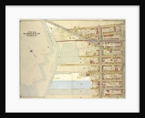
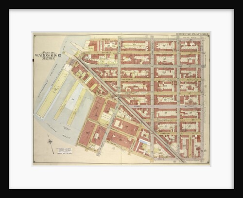
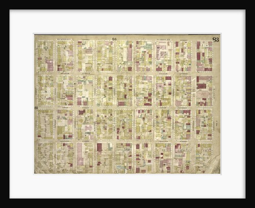
Map bounded by Lexington Ave., Patchen Ave., Macon St; IncludingLewis Ave., Putnam Ave., Sumner Ave., New York
Anonymous
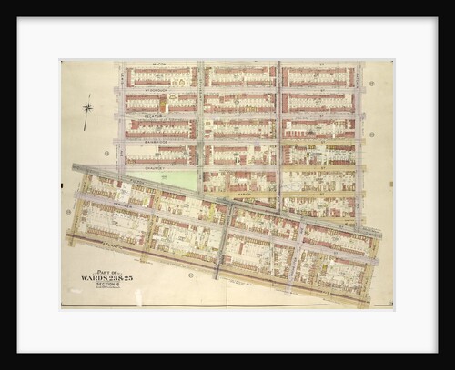
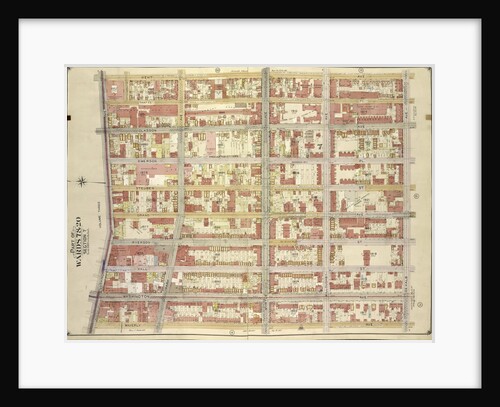
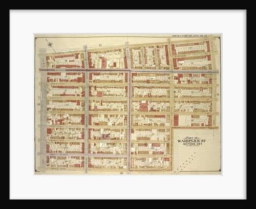
Map bounded by Macon St., Patchen Ave., Buffalo Ave; IncludingAtlantic Ave., Troy Ave., Fulton St., Lewis Ave., New York
Anonymous
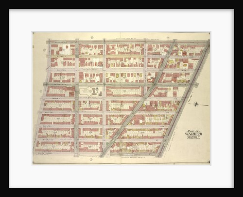
Map bounded by Flushing Ave., Broadway, Lewis Ave; IncludingHart St., Marcy Ave., New York
Anonymous
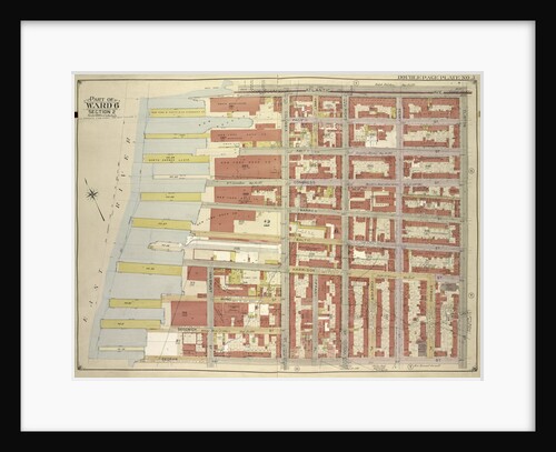
Map bounded by Flushing Ave., Marcy Ave; IncludingWilloughby Ave., Kent Ave., New York
Anonymous
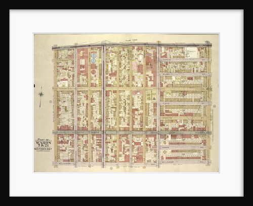
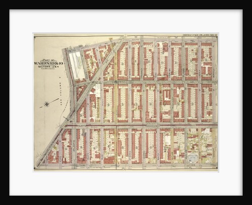
Map bounded by Madison St., Tompkins Ave; Including Brooklyn Ave., Atlantic Ave., Bedford Ave., New York
Anonymous
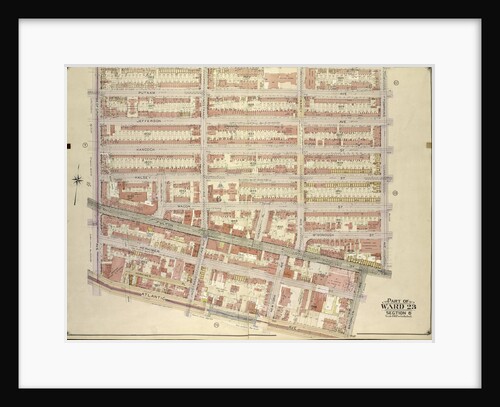
Map bounded by Gates Ave., Bedford Ave; Including Atlantic Ave., Washington Ave., New York
Anonymous
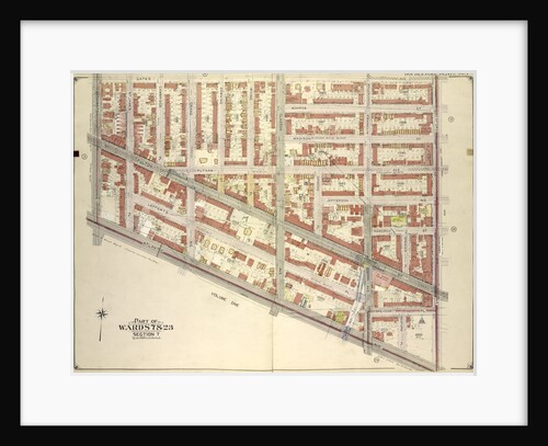
Map bounded by De Kalb Ave., Bedford Ave; IncludingGates Ave., Washington Ave., New York
Anonymous
Map bounded by Kent Ave., Be Kalb Ave; Including Waverly Ave., Flushing Ave., New York
Anonymous
Map bounded by Waverly Ave., De Kalb Ave; Including North Elliott PL., Flushing Ave., New York
Anonymous
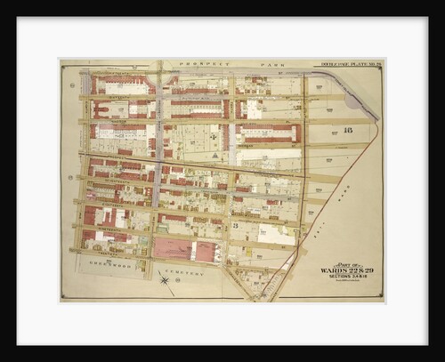
Map bounded by Washington Ave., Atlantic Ave; Including South Oxford St., De Kalb Ave., New York
Anonymous
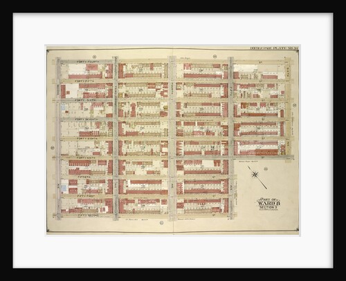
Map bounded by 44th St., 6th Ave., 49th St; Including 5th Ave., 42nd St., 2nd Ave., New York
Anonymous
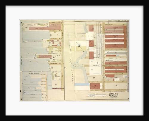
Map bounded by 52nd St., 44th St., 2nd Ave., 1st Ave., 45th St., 46th St., 47th St., 48th St., 49th...
Anonymous
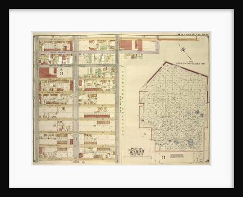
Map bounded by Fort Hamilton Ave., 37th St., 7th Ave., 36th St., New York
Anonymous
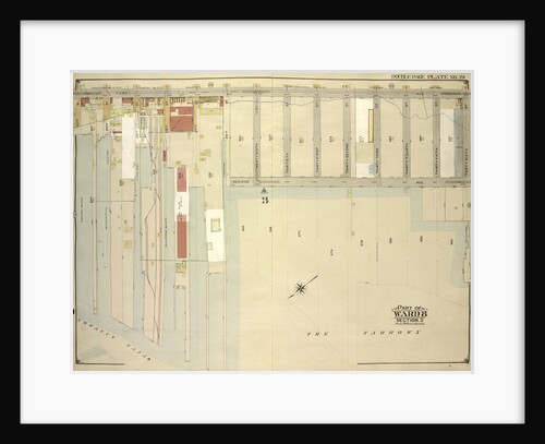
Map bounded by 3rd Ave., 36th St; Including2nd Ave., Gowanus Canal., New York
Anonymous
Map bounded by Hamilton Ave., 15th St., 4th Ave; Including23rd St., Gowanus Canal., New York
Anonymous
Map bounded by 16th St., 8th Ave., 12th St; Including7th Ave., 23rd St., 4th Ave., New York
Anonymous
Map bounded by 15th St., Coney Island Road, Old City Line, 11th Ave; IncludingTerrace PL., Gravesend Ave., 12th St., 8th...
Anonymous
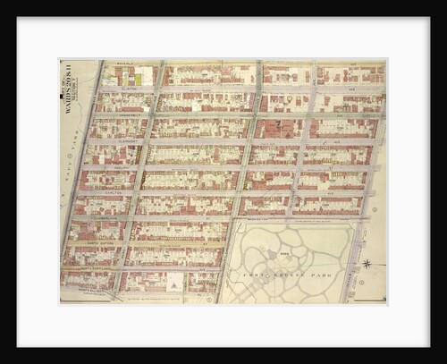
Map bounded by Atlantic Ave., Franklin Ave; Including Sterling PL., Underhill Ave., New York
Anonymous
Map bounded by Atlantic Ave., Underhill Ave., Sterling PL., St. John PL; IncludingFlatbush Ave., 7th Ave, 6th Ave., New York
Anonymous
Map bounded by 6th Ave., Berkeley PL., Sackett St; Including3rd Ave., Flatbush Ave, Atlantic Ave., New York
Anonymous
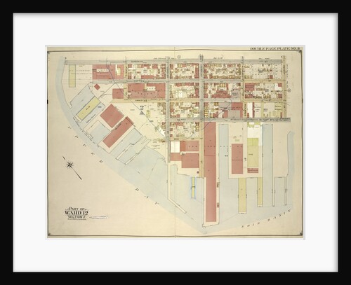
Map bounded by Gowanus Canal, Henry St., Bush St; IncludingCourt St., Hamilton Ave., Smith St., New York
Anonymous
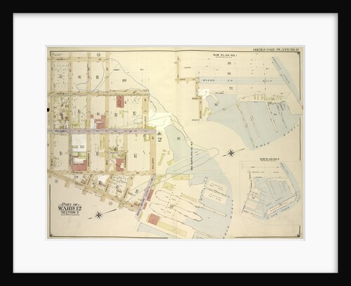
Map bounded by Bay St., New York
Anonymous
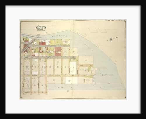
Map bounded by Dikeman St., Dwight St; Including Eire Basin, Upper Bay, New York
Anonymous
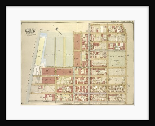
Map bounded by Commerce St., Seabring St., Columbia St., Dwight St., Dkeman St; IncludingWolcott St., Sullivan St., King St., Clinton...
Anonymous
Map bounded by Degraw St., Henry St., Coles St., Seabring St., Van Brunt St., Commerce St; Including Commercial Wharf Conover...
Anonymous
Map bounded by Atlantic Ave., Clinton St., Degraw St., Sedgwick St., Van Brunt St; Including Baltic St., Warren St., Congress...
Anonymous
Map bounded by Atlantic Ave., Furman St., Columbia Heights; IncludingCranberry St., Fulton St., Clinton St., New York
Anonymous
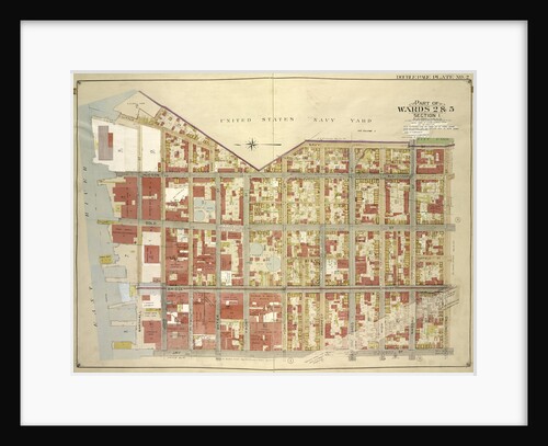
Map bounded by Little St., Evans St., Hudson Ave., Navy St; IncludingConcord St., Jay St., Marshall St., New York
Anonymous
Map bounded by 7th St., 8th St., 4th Ave; Including15th St., Hamilton Ave., Gowanus Canal, New York
Anonymous
Map bounded by 3rd Ave., 7th St., Smith St; Including4th St., Hoyt St., Douglass St., New York
Anonymous
Map bounded by 6th Ave., 8th Ave; Including3rd Ave., Sackett St., Berkeley PL., New York
Anonymous
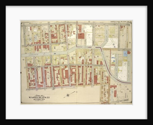
Map bounded by Orient Ave., Olive St., Maspeth Ave., Newtown Creek, Haussman St., Webster St., Jockson St., Wright St., Broom...
Anonymous
Map bounded by Metropolitan Ave., Morgan Ave., Stagg St., Humbolt St., Devoe St., Bushwick Ave., Ten Eyck St., Judge St;...
Anonymous
Map bounded by Humboldt St., Johnson Ave., Graham Ave., Ewen St
Anonymous
« Previous
1
…
257
258
259
260
261
…
695
Next »
Recently viewed
Clear history