☰ Menu
Images
Products
Log in
Basket:
0
items
Popular
Subjects
Artists
Collections
Art prints
Frames
Canvases
Postcards
Gift cards
Boundary line of city of new york posters & prints
Showing 1 to 36 of 1000
Search these images +
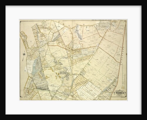
Map bounded by South St., Country Road, Old Country Road, Jamaica Plank Road; Including Boundary Line Of City Of New...
Anonymous
Map bounded by Boundary Line of City of New York, New York
Anonymous
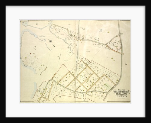
Map bounded by Conduit Long Island R.R., Boundary Line Of The City of New York; Including Hook Canal Creek, Jamaica...
Anonymous
Bounded by 58th Street, Twentyfirst Avenue, 72nd Street and Fourteenth Avenue, New York
Anonymous
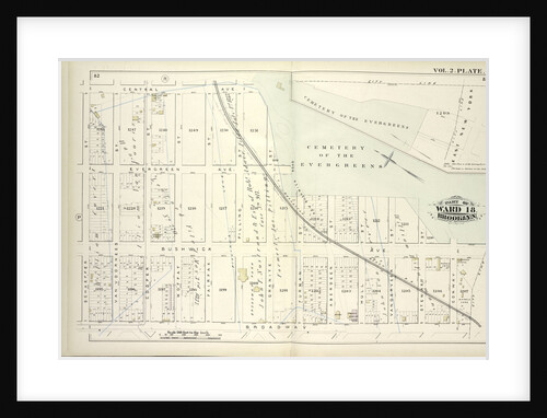
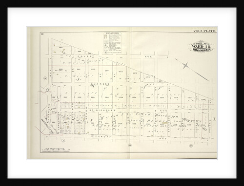
Map bound by Central Ave., Cemetery of the Evergreens, City Line, Broadway, Schaeffer St; Including Evergreen Ave., Bushwick Ave., Van...
Anonymous
Map bounded by Boundary Line of the Borough of Brooklyn and Queens, Elderts Lane, New York
Anonymous
Map bound by City Line, Greene St., Wyckoff Ave., Flushing Ave; Including Covert Ave., Cypress Ave., St. Nicholas Ave., Jefferson...
Anonymous
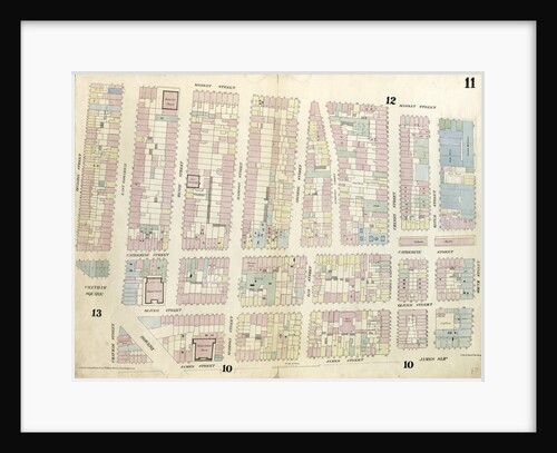
Map bounded by Chatham Square, Division Street, Market Street, South Street, James Slip, James Street. 1857
Anonymous
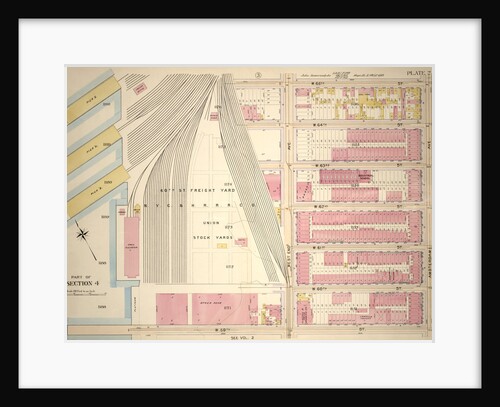
Bounded by W. 65th Street,Amsterdam Avenue, W. 59th Street and N.Y.C. & H.R.R.C.R. Union Stock Yards West End Avenue, New...
Anonymous
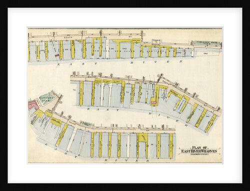
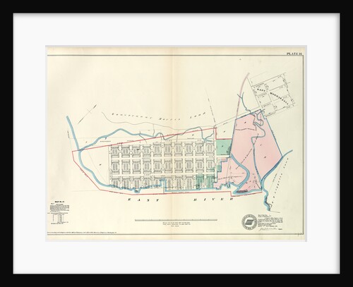
Bounded by Avenue A, E. 76th Street, Exterior Street and E. 67th Street, New York
Anonymous
Bounded by W. 32nd Street, Ninth Avenue, W. 26th Street and Eleventh Avenue, New York
Anonymous
Map bound by Hamilton Ave., Carroll St., Columbia St., Verona St., East River; Including India St., Atlantic Basin, Summit St.,...
Anonymous
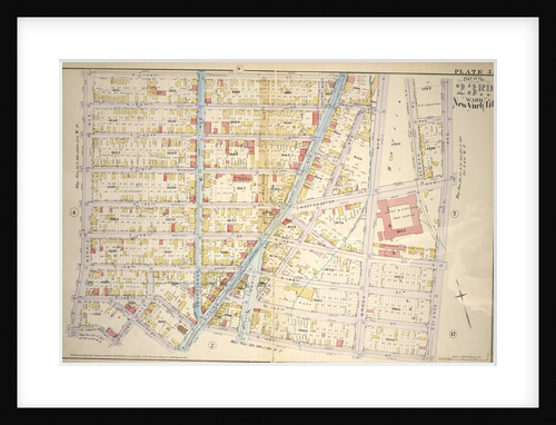
Borough of the Bronx. Bounded by Harrison Avenue, W. 181st Street, E. 181st Street, Grand Boulevard, Mt. Hope Place, Jerome...
Anonymous
Bounded by Corlears Street, Pierhead Line Piers 45-1, Battery Park, Whitehall Street, and South Street, New York
Anonymous
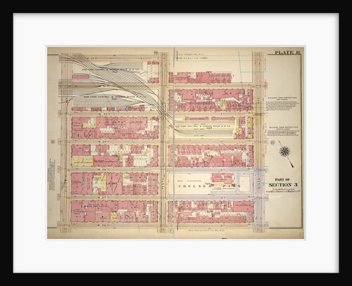
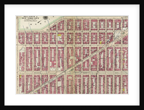
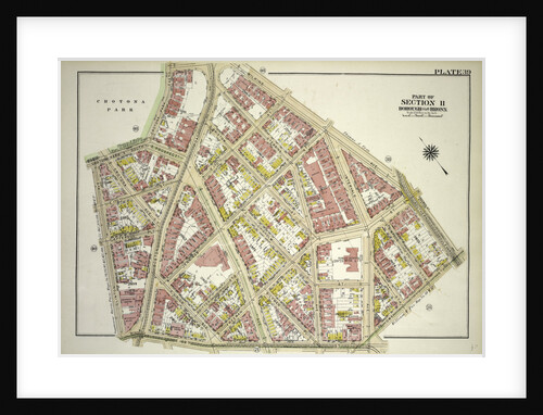
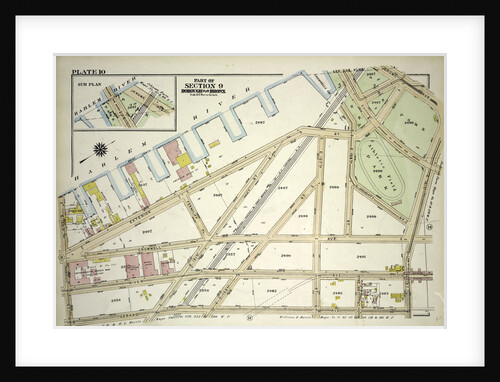
Part of Section 7: New York City
Anonymous
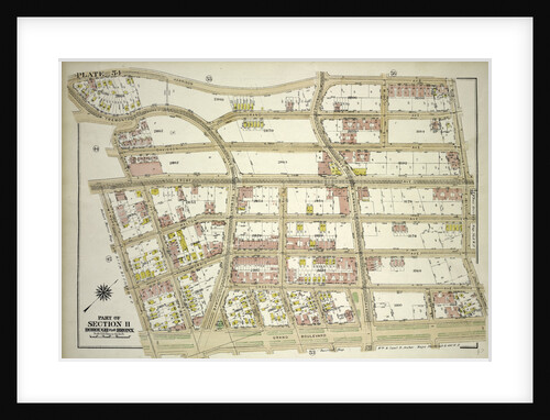
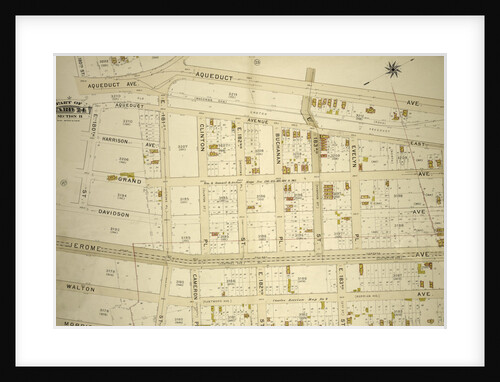
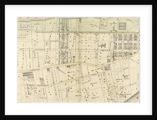
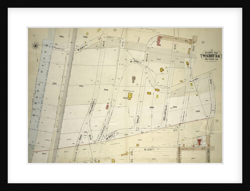
Part of Ward 24, Section 11. Bounded by E. 180th Street, Aqueduct Avenue, E. 184th Street, Morris Avenue and Burnside...
Anonymous
Bounded by E. 154th St., Brook Ave., Westchester Ave., St. Anns Ave., E. 145th St., N. Third Ave., E. 145th...
Anonymous
Borough of the Bronx. Bounded by West Tremont Avenue, Andrews Avenue W. 176th Street and University Avenue, New York
Anonymous
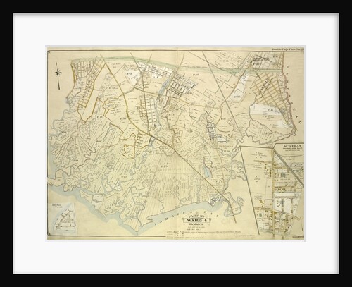
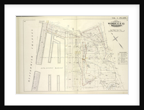
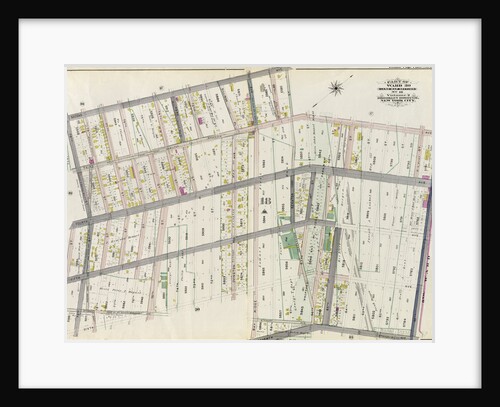
Part of Wards 18 & 27. Land Map Sections, Nos. 18 & 27. Volume 1, Brooklyn Borough, New York City
Anonymous
Borough of the Bronx. Bounded by Westchester Avenue, E. 163rd Street, Hunts Point Avenue, Barretto Street, Lafayette Avenue, Barry Street,...
Anonymous
Borough of the Bronx. Bounded by Netherland Avenue, W. 235th Street, Spuyten Duyvil Road, W. 236th Street and Broadway, New...
Anonymous
Borough of the Bronx. Bounded by Clinton Avenue, Crotona Park South, Crotona Park East, Wilkins Avenue, Southern Boulevard, Home Street...
Anonymous
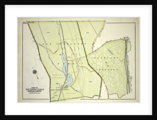
Borough of the Bronx. Bounded by Broadway, Van Cortlandt Park South, Gun Hill Road, E. 211th Street, Webster Avenue, E....
Anonymous
Map bounded by City Hall Square, Frankfort Street, Gold Street, Maiden Lane, Broadway, Park Row. 1857
Anonymous
Map No. 17 Bounded by Third Avenue, First Street, East River and Eleventh Street, New York
Anonymous
Borough of the Bronx. Bounded by E. Harlem River Piers Exterior Street, Jerome Avenue, E. 161st Street, Gerard Avenue and...
Anonymous
Bounded by Harlem River, W. 166th Street, Hudson River, New York
Anonymous
Map bounded by West 67th Street, Eighth Avenue, West 62nd Street, Tenth Avenue. 1857
Anonymous
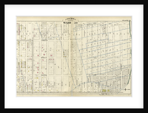
Part of Ward 24. City of Brooklyn, New York
Anonymous
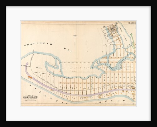
Bounded by Bay 46th Street, Harway Avenue, Avenue Z, Stillwell Avenue and Atlantic Ocean Surf Avenue, New York
Anonymous
Atlas of the borough of the Bronx, city of New York, by and under the supervision of Hugo Ullitz
Anonymous
Map bounded by West 32nd Street, Eighth Avenue, West 27th Street, Tenth Avenue. 1857
Anonymous
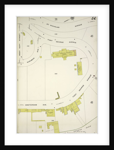
Map bounded by St. Nicholas Ave., Amsterdam Ave., New York
Anonymous
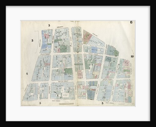
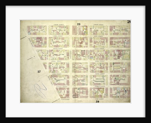
Map bounded by Ludlow Street, Rivington Street, Ridge Street, Division Street; Including Rutgers St, Essex Street, Norfolk Street, Jefferson St,...
Anonymous
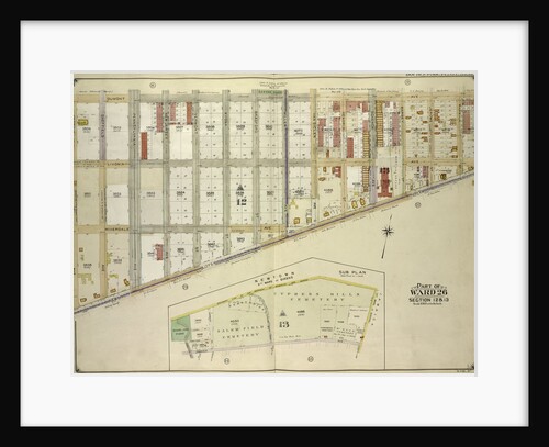
Part of Ward 30, Land Map Section, No. 18. Volume 2, Brooklyn Borough, New York City
Anonymous
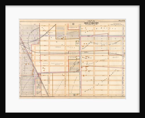
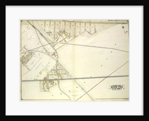
Map bounded by Metropolitan Ave. Williams Burg Turnpike, Ward Boundary line between Newtown and Jamaica, Myrtle Ave., Trotting Course Lane,...
Anonymous
1
2
3
…
28
Next »
Recently viewed
Clear history