☰ Menu
Images
Products
Log in
Basket:
0
items
Popular
Subjects
Artists
Collections
Art prints
Frames
Canvases
Postcards
Gift cards
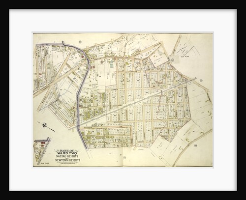
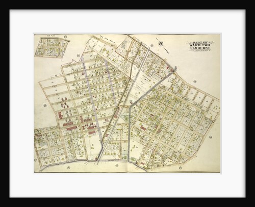
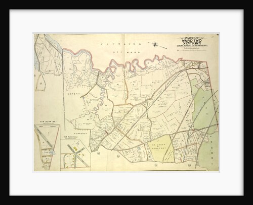
Part of ward two nassau heights and newtown heights posters & prints
Showing 1 to 36 of 282
Search these images +
Map bounded by Broadway, Court St., Horse Brook Road, Hoffman Boulevard, Trotting Course Lane, Dry Harbor, Hnson Ave., Bowne St.,...
Anonymous
Map bounded by Newtown Ave., Covert Ave. Betts Ave., Old Brook School Road, Maurice Ave; Including Astoria Ave., Maspeth Ave.,...
Anonymous
Map bounded by Court St., Marlowe Ave., Romolus St., Otis Ave., Rehan PL; Including North Hempstead Plank Road, Astoria Road,...
Anonymous
Map bounded by Union Turnpike, Hoffman Boulevard, Lefferts Ave., Muller Ave; Including Augustin Ave, Newtown Road, Boundary line between Jamaica...
Anonymous
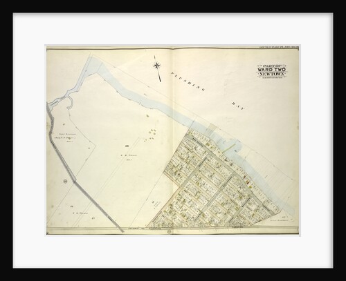
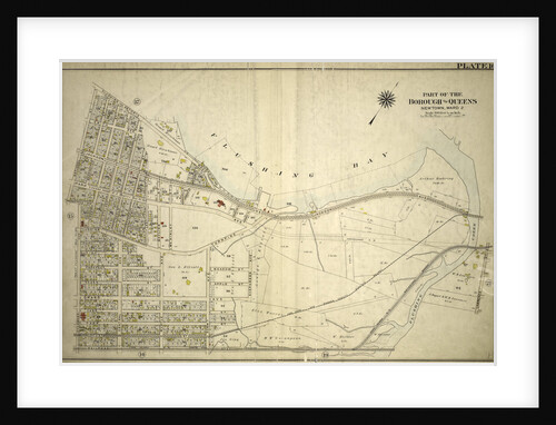
Map bounded by Flushing Bay, Flushing Creek, Mill Creek, Corona Hempstead Plank Road, Longview St., Fairview St., Home St., Orchard...
Anonymous
Map bounded by Hunter PL., Charlotte Ave., Newtown PL; Including Jackson Ave., Bowery Bay Road, Astoria and Flushing Turnpike, New...
Anonymous
Map bounded by Flushing and Newtown Road; Including Junction Ave; Part of Ward Two Newtown; Old Bowery Road, Old Junction...
Anonymous
Map bounded by Long Island City, Cabinet St., Bowery Bay Road, Shore Road; Including Old Bowery Bay Road, Kouvenhoven Ave.,...
Anonymous
Map bounded by Mt. Olivet Ave., Way Ave., Juniper Ave; Including Metropolitan Ave., Fresh Pond Road, New York
Anonymous
Map bounded by north Hempstead Plank Road, Livingstone St; Including Hoffman Boulevard, White Pot Road, Astoria Road, New York
Anonymous
Map bounded by Metropolitan Ave. Williams Burg Turnpike, Ward Boundary line between Newtown and Jamaica, Myrtle Ave., Trotting Course Lane,...
Anonymous
Map bounded by Woodside Ave., Celtic Ave. Highway to Calvary Cemetery, Hunters Point Ave; Including Borden Ave., New York
Anonymous
Map bounded by Flushing Bay, Bay Shore Terrace, Harbour PL; Including Sound View PL., Astoria and Flushing Turnpike, Old Bowery...
Anonymous
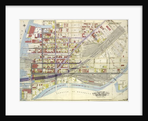
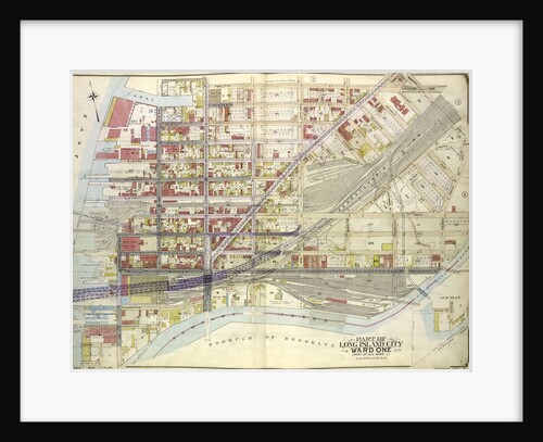
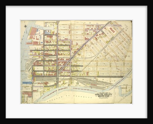
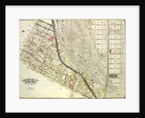
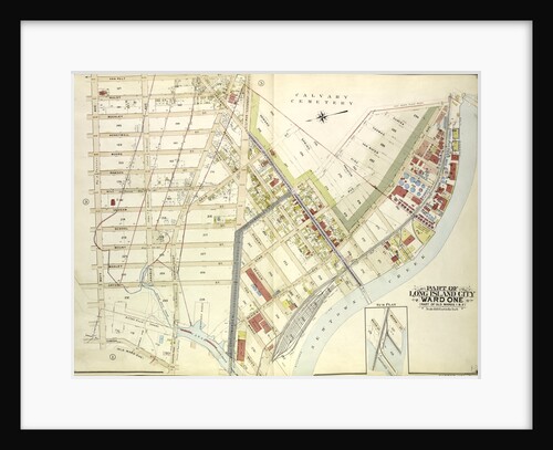
Map bounded by Pier St., River St., Front St., Newtown Creek; Part of Long Island City Ward One Part of...
Anonymous
Map bounded by Divison St., Vernon Ave., 12th St., Ely Ave., Homson Ave., Jackson Ave., Nott Ave., Creek Ave., Dutch...
Anonymous
Map bounded by Woodside Ave., Celtic Ave. Highway to Calvary Cemetery, Thomson Ave; Including Greenpoint Ave., Bushwick., New York
Anonymous
Map bounded by Division St., Vernon Ave., 12th St., Ely Ave., Jackson Ave., Thomson Ave., Nott Ave., Creek St., Dutch...
Anonymous
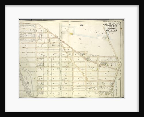
Map bounded by Roosevelt Ave., Division St., Junction Ave., Newtown Road, New York
Anonymous
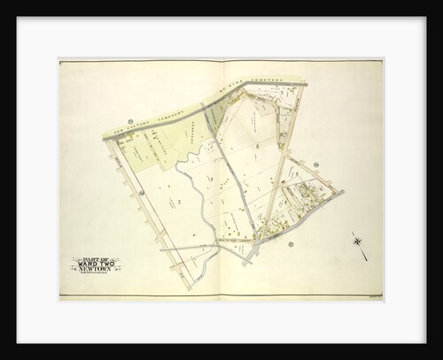
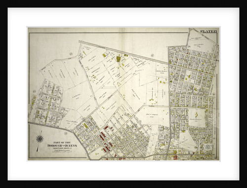
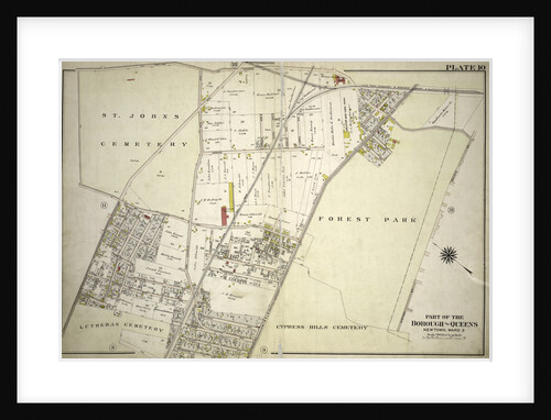
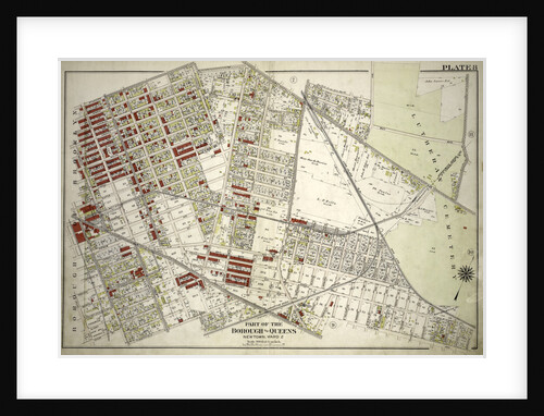
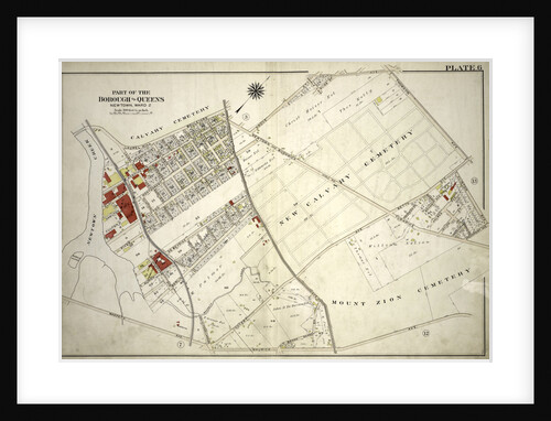
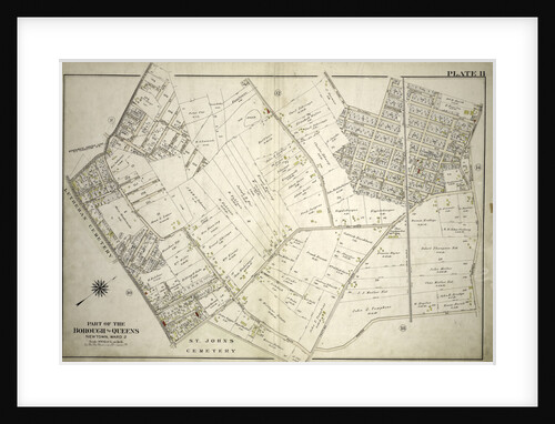
Part of the Borough of Queens, New town, Ward 2, New York
Anonymous
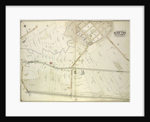
Part of the Borough of Queens, New town, Ward 2, New York
Anonymous
Map bounded by Flushing Creek, Old Town of Jamaica and Newtown, Boundary Line between Jamaica and Newtown, Dry Harbor Road,...
Anonymous
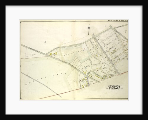
Part of the Borough of Queens, New town, Ward 2, New York
Anonymous
Part of the Borough of Queens, New town, Ward 2, New York
Anonymous
Part of the Borough of Queens, New town, Ward 2, New York
Anonymous
Part of the Borough of Queens, New town, Ward 2, New York
Anonymous
Map bounded by Woodside Ave., Broadway, Shell Road Newtown and Bushwick Turnpike, Thomson Ave., Maurice Ave., Manilla St; Including Calamus...
Anonymous
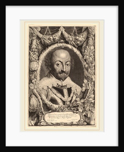
John, Count of Nassau, 1650?
Jonas Suyderhoff
Map bounded by Washington Ave., Webster Ave., Freeman Ave., Rapelje Ave., Beebe Ave., Payntar Ave., Wilbur Ave., Hunter Ave., Jackson...
Anonymous
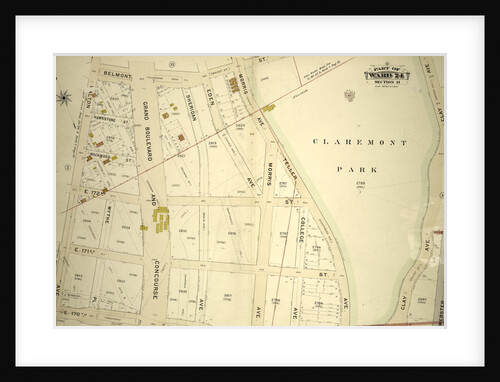
Part of Ward 24, Section 11. Bounded by Belmont Street, Clay Avenue, E. 170th Street and Walton Avenue, New York
Anonymous
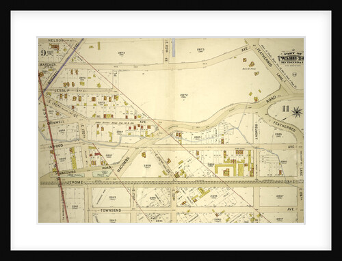
Part of Ward 24, Sections 9&11. Bounded by Nelson Avenue, Featherbed Lane, E. 174th Street, Walton Avenue, Elliot Place, Jemorem...
Anonymous
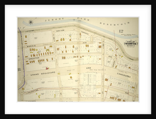
Part of Ward 24, Section 11. Bounded by Jerome Park Reservoir Jerome Avenue, E. 199th Street, Briggs Avenue and Kingsbridge...
Anonymous
Map bounded by Prospect St., Harris Ave., Hunter Ave., Jackson Ave., 12th St., Division St., West Ave., 13th St., 14th...
Anonymous
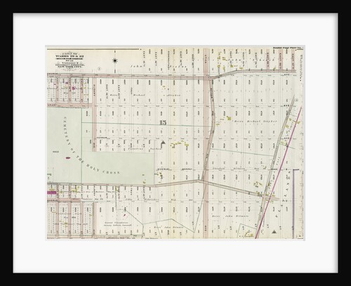
Part of Wards 29 & 32, Land Map Section, No. 15. Volume 2, Brooklyn Borough, New York City
Anonymous
Map bounded by Van Pelt St., Greenpoint Ave., Hunters Point Ave., Borden Ave., Howard St., Spring St., Preston St; Including...
Anonymous
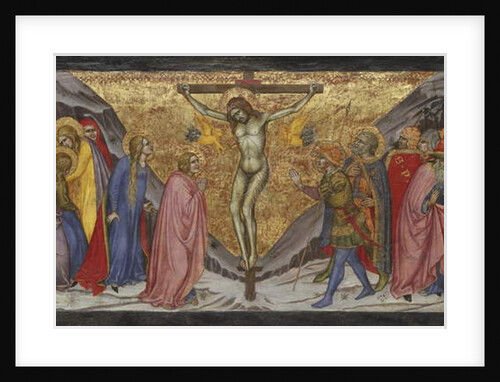
The Crucifixion, 1401/04
Taddeo di Bartolo
Map bounded by Winthrop Ave
Anonymous
1
2
3
…
8
Next »
Recently viewed
Clear history