☰ Menu
Images
Products
Log in
Basket:
0
items
Popular
Subjects
Artists
Collections
Art prints
Frames
Canvases
Postcards
Gift cards
Sections 12 & 13 posters & prints
Showing 1 to 36 of 588
Search these images +
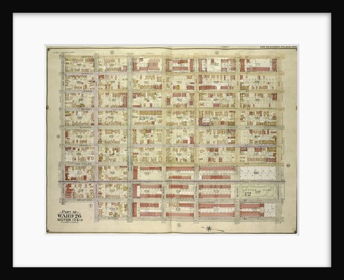
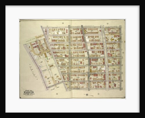
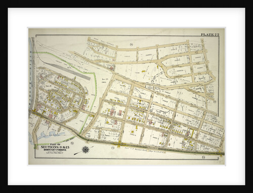
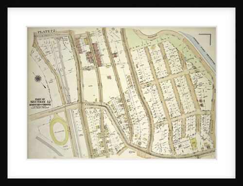
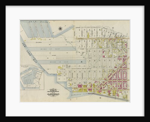
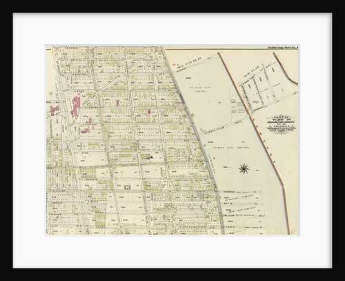
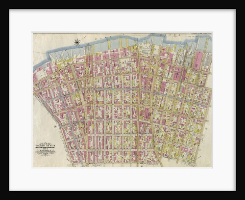
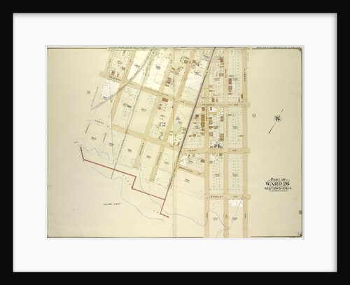
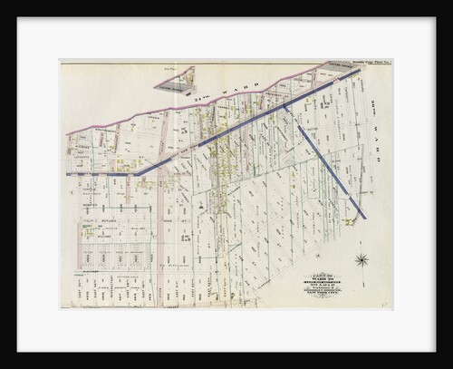
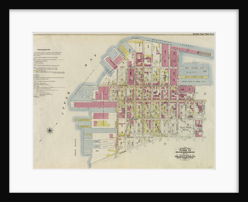
Part of Ward 26. Land Map Sections, Nos. 12 & 13. Volume 1, Brooklyn Borough, New York City
Anonymous
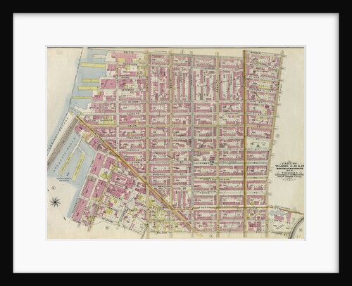
Map bounded by Boundary Line of the Borough of Brooklyn and Queens, Elderts Lane, New York
Anonymous
Map bounded by Ashford St., Dumont Ave., Wyona St; Including Glenmore Ave., Bradford St., Liberty Ave., New York
Anonymous
Map bounded by Atlantic Ave., Fountain Ave; Including Pitkin Ave., Ashford St., New York
Anonymous
Map bounded by Ashford St., Liberty Ave., Bradford St., Jamaica Ave; Including Miller Ave., Highland Blvd., Warwick St., New York
Anonymous
Map bounded by Elderts Lane, Atlantic Ave; Including Euclid Ave., Jamaica Ave., New York
Anonymous
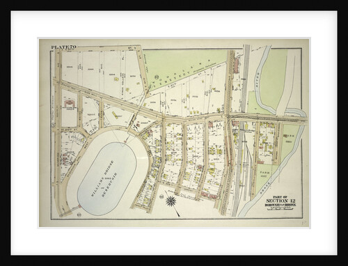
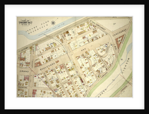
Borough of the Bronx. Bounded by Jerome Avenue, E. 204th Street, Grand Boulevard, E. 202nd Street, Briggs Avenue and E....
Anonymous
Map bounded by Hale Ave., Atlantic Ave., Ashford St; Including Jamaica Ave., Warwick St., Sunnyside Ave., New York
Anonymous
Borough of the Bronx. Bounded by Netherland Avenue, W. 235th Street, Spuyten Duyvil Road, W. 236th Street and Broadway, New...
Anonymous
Borough of the Bronx. Bounded by Briggs Avenue, E. Mosholu Parkway South, Webster Avenue, E. 197th Street, Bainbridge Avenue and...
Anonymous
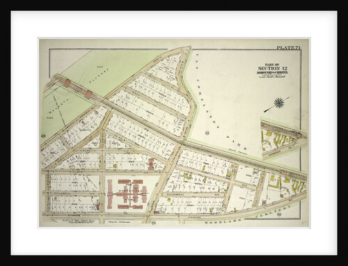
Borough of the Bronx. Bounded by Van Cortlandt Park South, Mosholu Parkway, Sedgwick Avenue, W. 238th Street, Ft. Indepndence Street,...
Anonymous
Borough of the Bronx. Bounded by E. Jerome Avenue, Bainbridge Avenue and E. 208th Street, New York
Anonymous
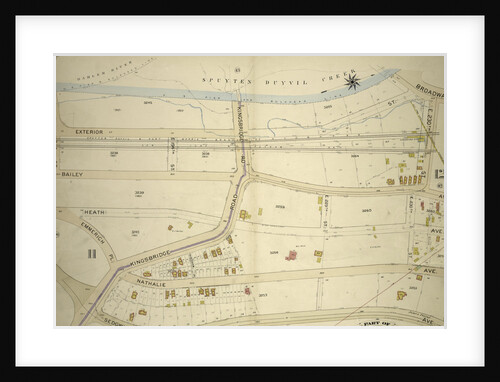
Borough of the Bronx. Bounded by Broadway, W. 230th Street, Reservoir Avenue, W. Kingsbridge Road and Exterior Street, New York
Anonymous
Borough of the Bronx. Bounded by Johnson Avenue, Spuyten Duyvil Road, W. 246th Street, Delafield Avenue, W. 250th Street, Broadway,...
Anonymous
Part of Ward 12. Land Map Section, No. 2, Volume 1, Brooklyn Borough, New York City
Anonymous
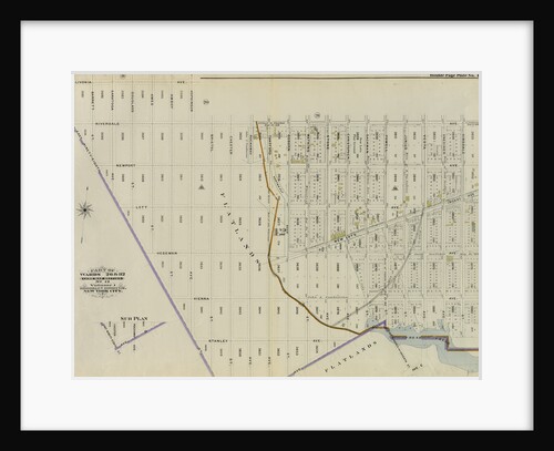
Part of Ward 24, Sections 11&12. Bounded by Broadway, E. 230th Street, Bailey Avenue, Boston Avenue, Sedgwick Avenue, Kingsbridge Rpad....
Anonymous
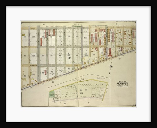
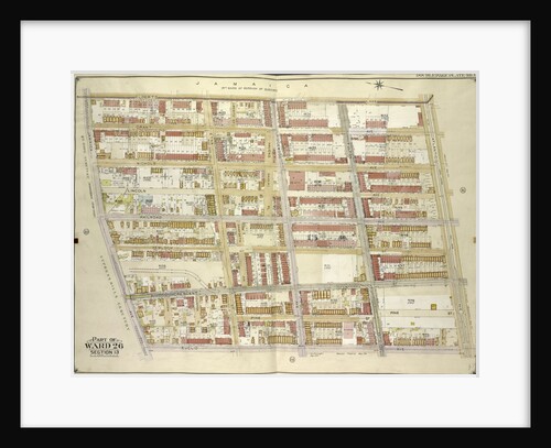
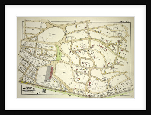
Part of Ward 26. Land Map Section, No. 13. Volume 1, Brooklyn Borough, New York City
Anonymous
Map bounded by Dumont Ave., Georgia Ave., New Lots Ave; Including Lott Ave., Thatford St., New York
Anonymous
Map bounded by Powell St., Dumont Ave; Including Bristol St., East New York Ave., New York
Anonymous
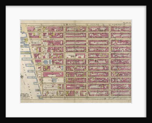
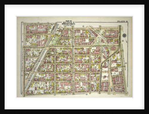
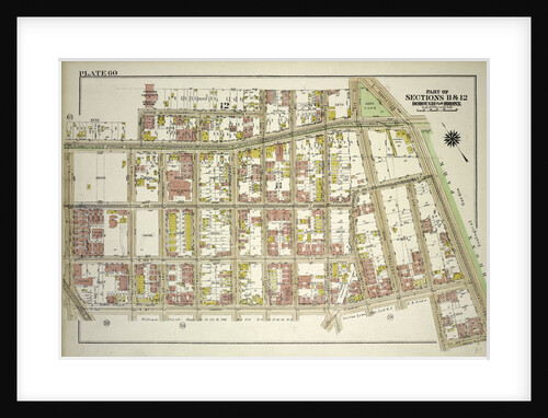
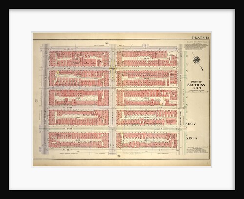
Part of Section 2: New York City
Anonymous
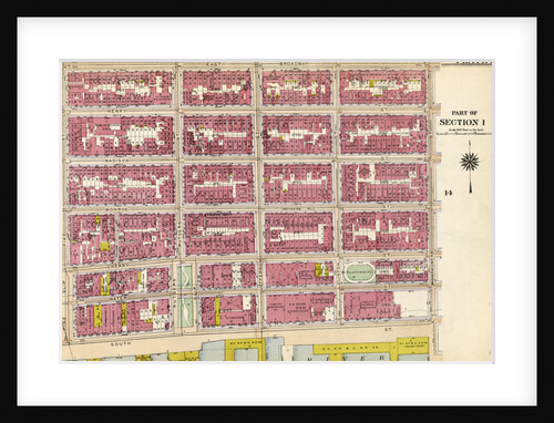
Part of Section 1: New York
Anonymous
Part of Wards 13 & 14. Land Map Section, No. 8, Volume 1, Brooklyn Borough, New York City
Anonymous
Borough of the Bronx. Bounded by E. 211th Street, Webster Avenue, Parkside Place, E. 209th Street, Perry Avenue, Holt Place,...
Anonymous
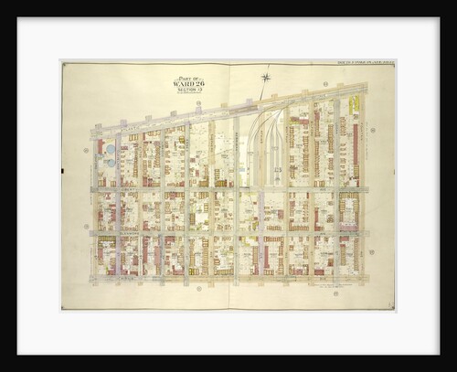
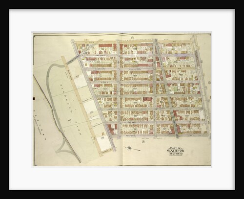
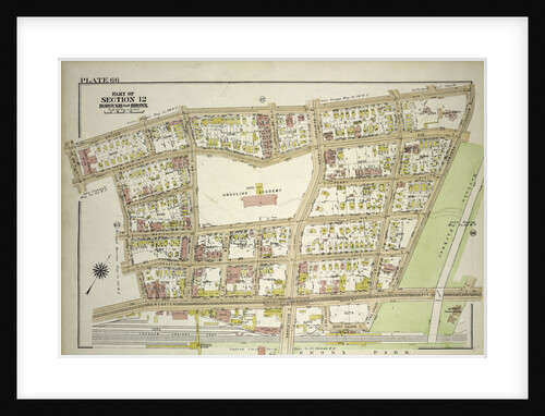
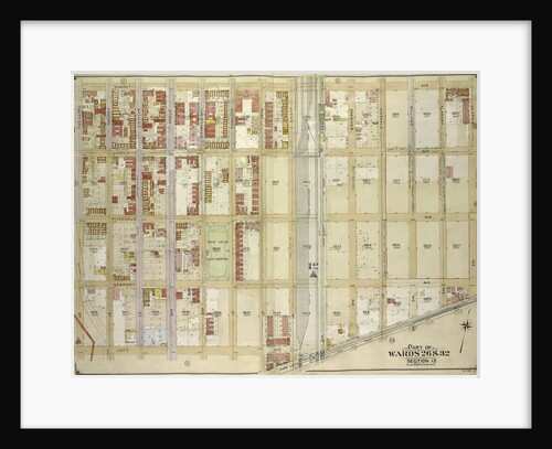
Part of Wards 26 & 32. Land Map Section, No. 12, Volume 1, Brooklyn Borough, New York City
Anonymous
Borough of the Bronx. Bounded by E. 163rd Street, St. Anns Avenue, E. 149th Street and Morris Avenue, New York
Anonymous
Map bounded by Newlots Ave., Alabama Ave., Stanley Ave; Including Fresh Creek, E. 107th St., Powell St., New York
Anonymous
Part of Wards 6,10 & 12. Land Map Section, No. 2, Volume 1, Brooklyn Borough, New York City
Anonymous
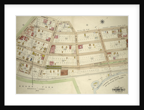
Borough of the Bronx. Bounded by E. Fordham Road, Bathgate Avenue, E. 191st Street, Hughes Avenue, E. Fordham Road, Southern...
Anonymous
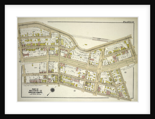
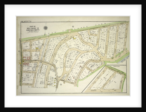
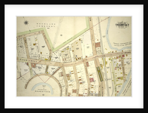
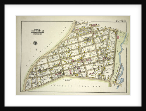
Part of Ward 24, Section 12. Bounded by E. 211th Street Woodlawn Cemetery, Webster Avenue, E. 209th Street, Reservoir Oval...
Anonymous
Bounded by W. 100th Street, Central Park West, W. 95th Street and Amsterdam Avenue, New York
Anonymous
Borough of the Bronx. Bounded by Van Cortlandt Park East, E. 242nd Street, Martha Avenue, E. 240th Street, McClean Avenue,...
Anonymous
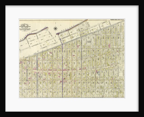
Part of Ward 29. Land Map Sections, Nos. 5, 12, & 15. Volume 2, Brooklyn Borough, New York City
Anonymous
Part of Ward 24, Section 12. Bounded by Bainbridge Avenue, E. 205th Street, Perry Avenue, E. 209th Street, Webster Avenue...
Anonymous
Sections
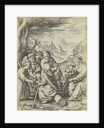
Edmond Fierlants
Part of Ward 24, Section 12. Bounded by Jerome Avenue, Mosholu Parkway North, Briggs Avenue and E. 199th Street, New...
Anonymous
Part of Ward 12. Land Map Section, No. 2, Volume 1, Brooklyn Borough, New York City
Anonymous
1
2
3
…
17
Next »
Recently viewed
Clear history